To maximize your trip to Martha’s Vineyard, it helps to know how to get around. The island is bigger than most people think at 87.5 square miles. The down island towns are walkable with plenty to see and do, but traveling between them with ease makes for a more enjoyable experience.
Here are some tips for getting around Martha’s Vineyard.
Where are The Ferries Located?
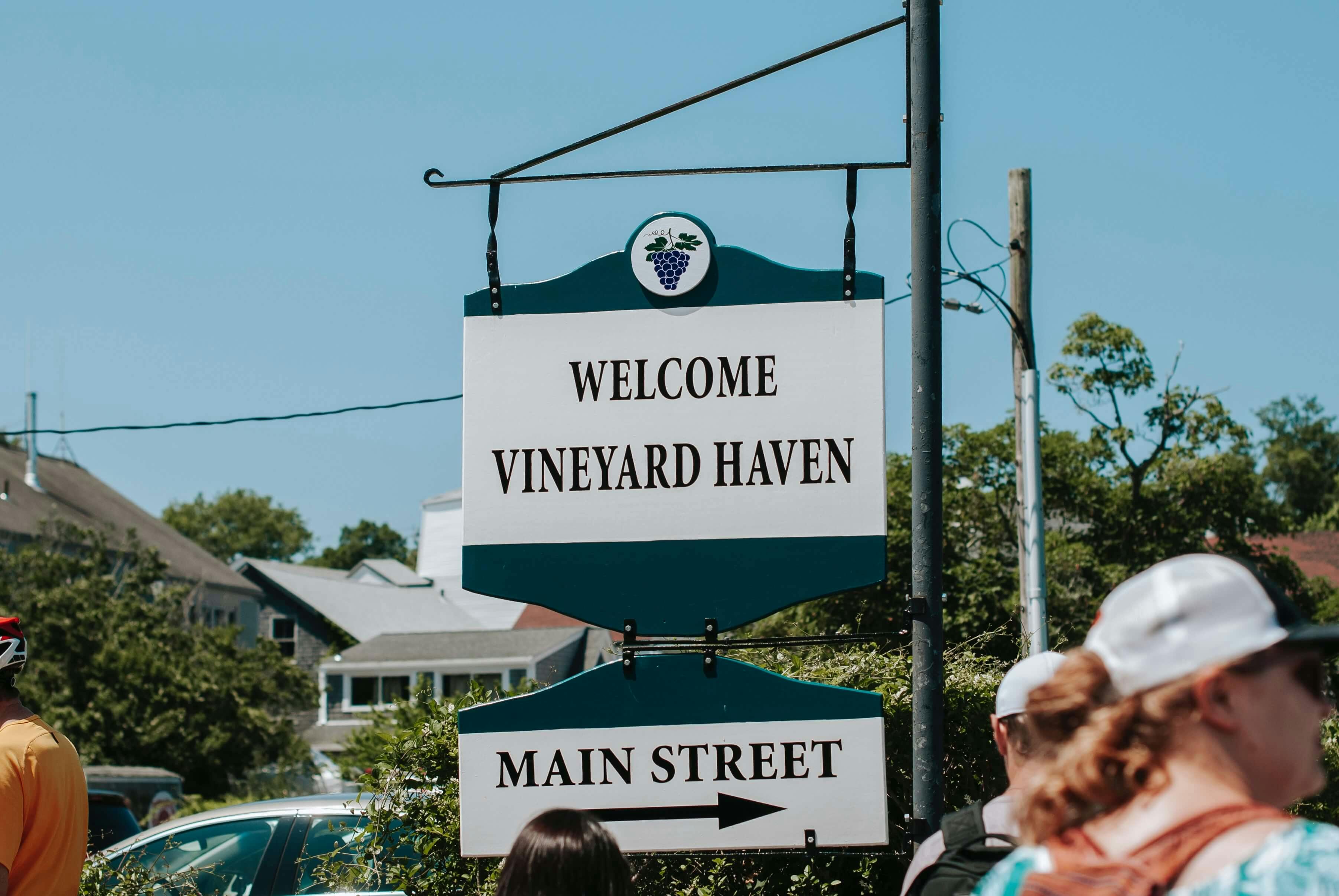
Ferries departing the mainland arrive in Vineyard Haven year-round. Ferries that dock in Oak Bluffs are seasonal, running from mid-May through mid-October. They transport bicycles and cars (with advance reservation) for an additional fee. This lovely, 45-minute ride from Woods Hole departs daily from about 6am to 10:30pm in season.
Can You Get Around Martha's Vineyard without a Car?
Rather than bring or rent a car on Martha’s Vineyard, many people rent bicycles or mopeds. Vineyard Public Transit provides bus service connecting the towns on Martha’s Vineyard. Private group tours and tour buses navigate Martha’s Vineyard with the added benefit of narration. There is taxi service year round and Uber or Lyft in the high-season.
How Can You Drive from Vineyard Haven to Oak Bluffs?
The direct route from Vineyard Haven to Oak Bluffs via Beach Rd. is about 9 minutes by car. The more scenic route takes just a little longer.
Day Trip Itinerary for Oak Bluffs
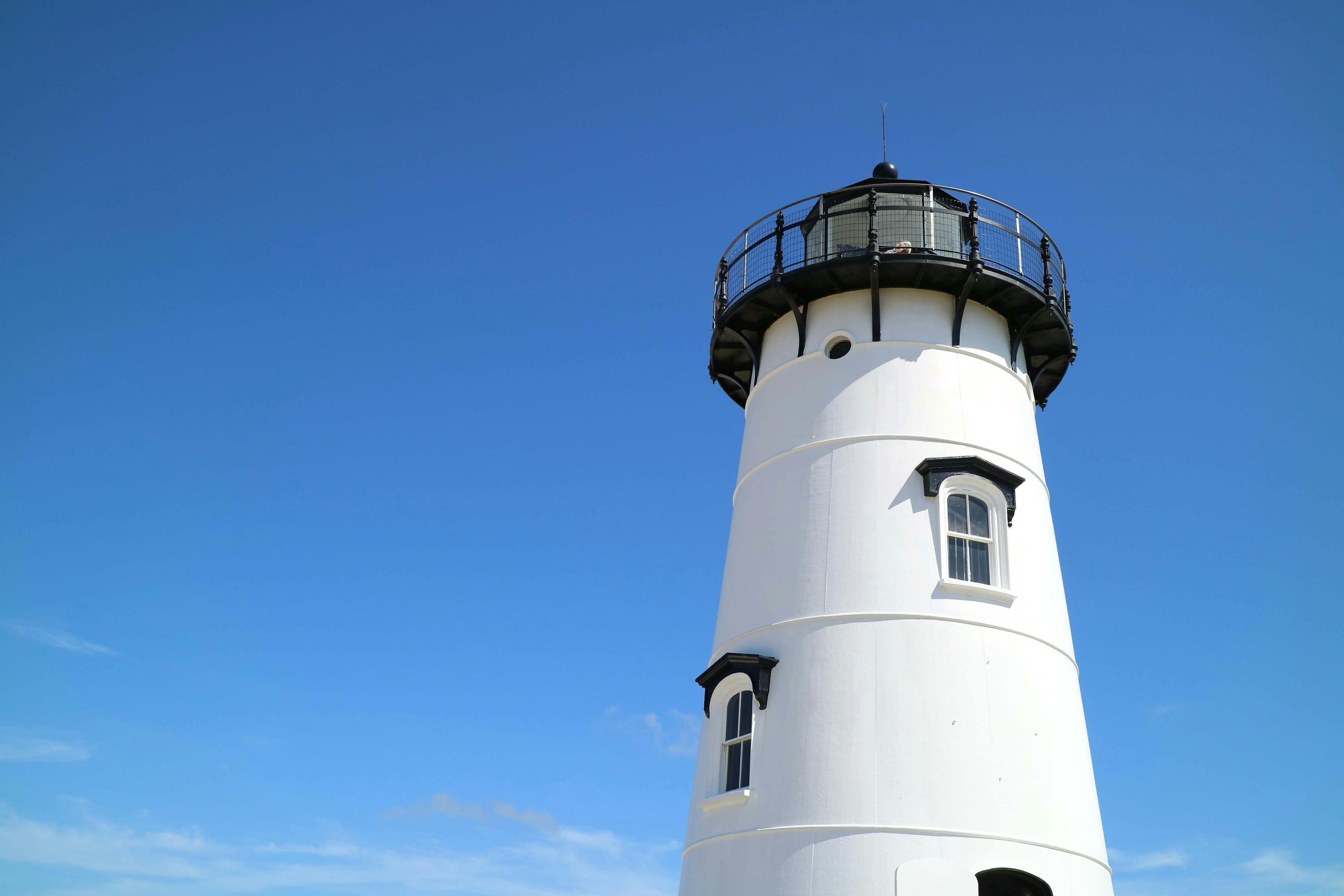
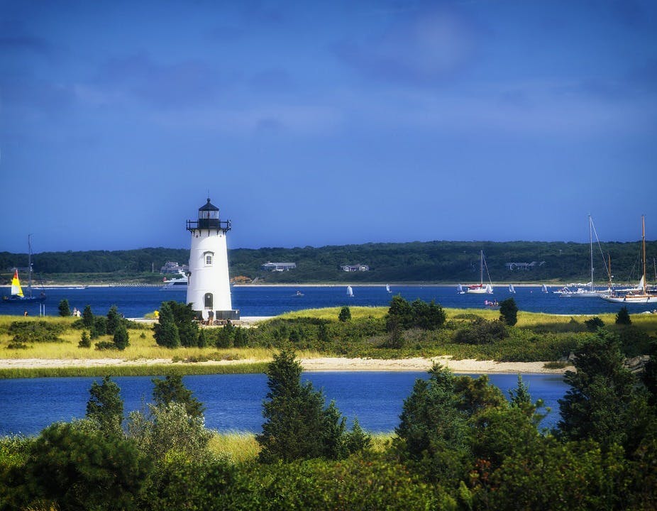
Take Beach Road to Eastville Ave., then bear left onto Temahigan. Next, turn left onto East Chop Drive. This is a stunning coastal route that leads to picturesque East Chop Lighthouse. This is a great stop for the view and to watch the ferries pass.
Then, continue past the lighthouse, turn left on New York Ave, follow straight past the harbor on your left and into town. Take a left on Kennebunk Ave and left again onto Oak Bluffs Ave. This brings you to the Flying Horses Carousel, where you can take a spin on the oldest continuously operating Platform carousel in the US.
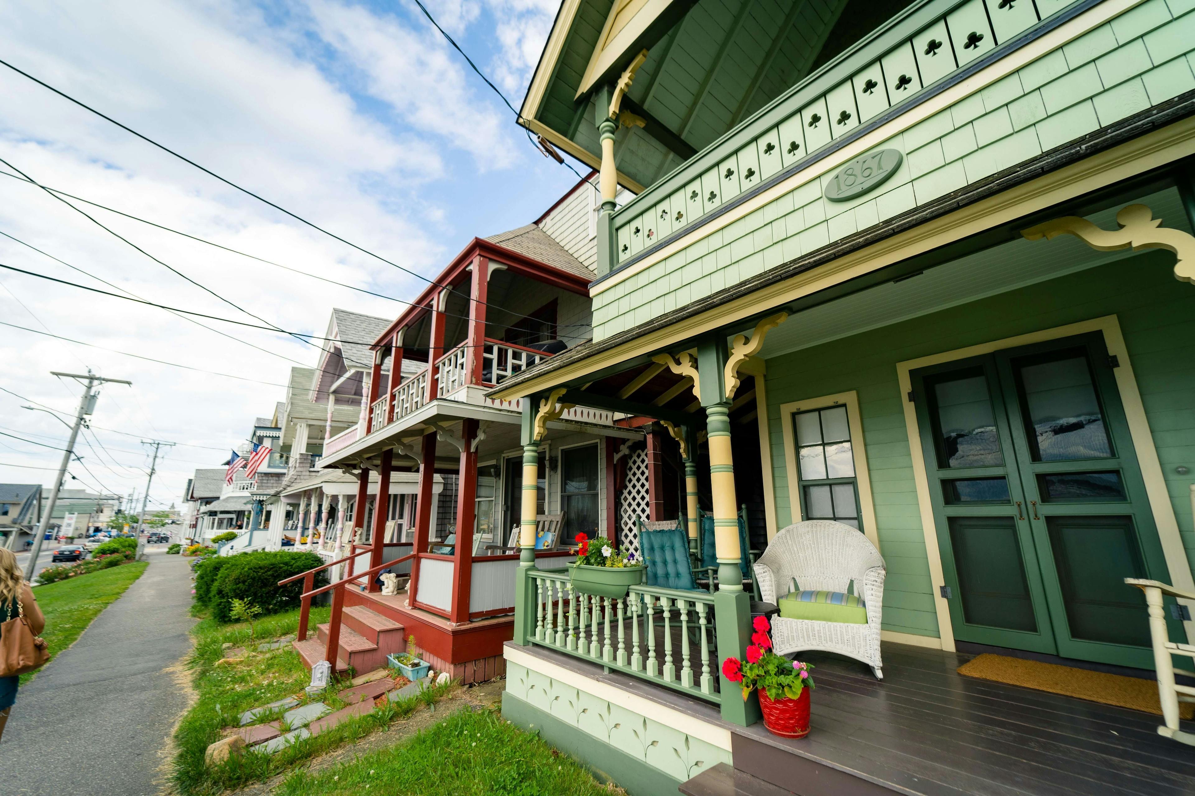
Double back onto Lake Ave, with the harbor now on your right, and turn left onto Silam Ave, staying left and then straight onto Jordan Crossing. A left turn onto Trinity Park arrives at the famous Gingerbread Houses in the Camp Meeting Association on Martha’s Vineyard. (Snap a selfie!)
This scenic route into Oak Bluff is short 4.5 miles and 18 minutes without stops.
How Can You Drive from Vineyard Haven to Edgartown?
The direct route from Vineyard Haven to Edgartown is a 20-minute car ride along Edgartown-Vineyard Haven Road to Upper Main Street, then Main Street all the way to Edgartown Harbor. then South Water Street.
Day Trip Itinerary for Edgartown
Once you are in Edgartown, check out the Edgartown Harbor Lighthouse, which marks the entry way to Edgartown Harbor and Katama Bay. It’s located on N. Water Street on a small man-made island reachable via a footbridge.
From there, head to Daggett Street. (You’ll have to loop around the block since N. Water Street is one-way) Hop on the $4 ferry at Memorial Wharf for a short ride (527 feet) over to Chappaquiddick Island. Mytoi Gardens, the Dyke Bridge and untouched Atlantic Ocean Beach at Wasque attract visitors throughout the year.
Then, head back to Edgartown for a visit to Katama Beach, also known as South Beach. To get there, take Peases Point Way to Katama Road. This barrier beach on the Atlantic Ocean is a perfect place to relax for the afternoon on the bay side or take in the surf on the Atlantic side.
How Can You Drive from Vineyard Haven to Chilmark?
The drive “up-island” to Chilmark takes about 25 minutes along State and North Rd. or along Old Country Road and South Rd where In season and the fall, the West Tisbury Farmer’s Market is open every Wednesday and Saturday morning at the new Agricultural hall and the Artisan Fair is held at the Grange in Old West Tisbury Center. If you continue on the South Rd you will arrive at the point farthest west on the island at the Town of Aquinnah with beautiful beaches and dramatic red clay cliffs as well as shops up at the Cliffs in season.
If you follow State Rd to North Rd out of Tisbury, you can continue straight to the fishing village of Menemsha with a beach that boasts outstanding sunsets or drive up to the summit of Peaked Hill in Chilmark, which is the highest point on the island at 311 feet.
Getting from Vineyard Haven to the Nantucket Ferry
Another great day trip from Martha’s Vineyard is to Nantucket. In season, the inter-island ferry leaves from Oak Bluffs and takes about an hour and fifteen minutes. A one-way fare is under $40. (Cars and bikes are extra).
Day Trip Itinerary for Nantucket
While in Nantucket:
- Stroll historic Nantucket town
- Tour the Nantucket Whaling Museum (Tip: don’t miss the rooftop view)
- Visit Sankaty Head Lighthouse
- Enjoy fine cuisine at Cru
Vineyard Haven Activities
Vineyard Haven makes a great home base on the Vineyard. Enjoy the Main Street shops, theater, restaurants, working harbor the Martha’s Vineyard Museum which covers island history and culture from pre-colonial times as well as the charming homes for rent.
Finally, enjoy casual waterfront dining at legendary pub, The Black Dog Tavern. One the harbor, you can also admire gorgeous sea vessels docked on the Atlantic.
Final Thoughts on How to Get Around Martha’s Vineyard
Martha’s Vineyard Towns each offer their own unique charm and attractions. When you know how to get around Martha’s Vineyard with ease, your island stay is that much better!